


By Patrick Beach
August is prime season for hurricanes, and Hurricane Harvey is still fresh on many Texans’ minds. Plenty of people in South Central Texas are still putting their lives back together after the devastating 2017 storm.
But we learned lessons from Harvey. Among them:
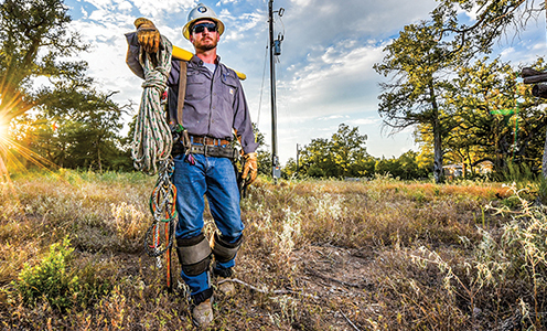
- Inland flooding is often worse than where a storm makes landfall. People many miles from the Gulf coast may have a false sense of security because they think they’re out of harm’s way. In fact, storms can cause significant flooding far inland, even after the storm has come ashore and weakened. There was flooding across Bluebonnet Electric Cooperative’s service area, and Harvey’s winds and rain led to 396 outages that impacted 12,760 members.
- Similarly, the National Hurricane Center cautions against focusing on the center of the storm. Several Florida counties along the Atlantic Coast evacuated ahead of another major 2017 hurricane, Irma, citing projections thought to be reliable at the time. But the hurricane changed track from the east to the west coast of the Sunshine State, catching residents along its Gulf Coast unprepared. Even a couple of days from landfall, storm projections can be off by as much as 80 miles.
- Even if you’re not near a river or creek, you’re not always safe from a slow-moving disaster. The National Flood Insurance Program (run by the Federal Emergency Management Agency, or FEMA) has said that 20 percent of the claims it pays have happened in places considered “low-risk” for flooding. Remember, Harvey dropped a record 60.58 inches of rain on Nederland, just southeast of Beaumont. There’s simply no place for that much water to go, especially if the terrain in your area is as flat as a pool table.
- If you’re not sure whether you have flooding insurance, you probably don’t. Homeowners’ policies usually include coverage for rain and wind damage, but not flooding. That requires a separate policy, often purchased through the national program (although it is also available through a few private insurers). The FEMA program covers damage up to $250,000 to homes and up to $100,000 for belongings. Keep in mind, there is often a monthlong waiting period before a new policy goes into effect. Policies aren’t cheap (the Texas Department of Insurance says an average policy is $700 a year, but that varies based on your location). If you take steps to protect your property, premiums can cost less. Get information at fema.gov/national-flood-insurance-program.
- Even though flooding can happen anytime, anywhere, FEMA has a flood map service center that lets you find your location and any relevant flood hazard information in your neighborhood. It also has other flood hazard tools to help you understand flooding risks. Go to msc.fema.gov/portal.
The 2018 Hurricane Forecast
Each year the National Oceanic and Atmospheric Administration’s Climate Prediction Center releases a general hurricane outlook guide for the North Atlantic to the Caribbean and Gulf of Mexico. It does not make landfall predictions because those are impossible to predict until a storm is only days away — if then.
NOAA looks at climate factors known to have an effect on hurricanes and climate models that “directly predict seasonal hurricane activity.” In May, its outlook for this year predicted a 40 percent chance of a normal or near-normal hurricane season, followed by a 35 percent chance of above-normal activity and a 25 percent chance of a below-normal season. That means there is a 70 percent probability for 10 to 16 named storms, including five to nine hurricanes, up to four of them major.
When NOAA issued that outlook in May it reported little or no El Niño (unusually warm water) or La Niña (unusually cool water) activity in the Pacific, which can be a variable in Atlantic storm activity. The agency will update its outlook this month, typically the peak of hurricane season, when sea air and water are warmest.
On July 2, Colorado State University’s tropical weather project lowered its predicted number of hurricanes to only four in 2018, with a 22 percent probability of a direct hit to the eastern U.S. The project’s forecasters cited cooler Atlantic waters and a likely Pacific El Niño that can lessen the impact of tropical cyclones.
Where storms will hit and how severe they’ll be is, of course, unknowable because of the vagaries of daily weather patterns. That’s why there are no longer-range hurricane projections. What NOAA can predict with some confidence is a continuation of increased hurricane activity in the Atlantic that began in 1995.
By early July this year, tropical storms Alberto and Chris and Category 1 hurricane Beryl had made an appearance. Alberto caused more than $50 million in damage and at least 12 deaths in Cuba and the U.S.
Hurricane season lasts until Nov. 30.
Worst of the Worst: The 10 Deadliest U.S. Hurricanes
Scientific advances make predicting and tracking tropical storms more reliable, even as more Americans flock to live near a coast. Hurricane Harvey, which made landfall at Rockport-Fulton, caused at least 107 deaths. Nine of the 10 deadliest hurricanes hit the U.S. mainland before 2000. Most were in the 1800s and early 1900s, when there was little warning of an approaching storm. Most death tolls are estimated, including offshore deaths.
1. Great Galveston Storm, 1900. The deadliest natural disaster in U.S. history, this hurricane took at least 8,000 lives with its estimated winds of 135 mph and storm surge of more than 15 feet.
2. Okeechobee Hurricane, 1928, Palm Beach County, Fla. Some 2,500-3,000 killed.
3. Hurricane Katrina, New Orleans, 2005. Some 1,200 deaths.
4. Cheniere Caminada Hurricane off Louisiana, 1893. Almost 2,000 deaths, some offshore in boats.
5. Sea Islands Hurricane near Savannah, Ga., 1893. As many as 2,000 deaths, most from storm surge.
6. Georgia-South Carolina Hurricane, 1881. An estimated 700 deaths.
7. Atlantic-Gulf Hurricane, 1919. Passed near the Florida Keys before hitting the Texas Gulf Coast, causing some 600 deaths, including many offshore.
8. Great New England Hurricane, 1938. Made landfall on Long Island and in Connecticut, causing 600 deaths, many offshore.
9. Hurricane Audrey, 1957, Texas-Louisiana border. At least 416 deaths.
10. Florida Keys Labor Day Hurricane, 1935. Believed to be a Category 5 storm that killed an estimated 408.
Source: Report, National Oceanic and Atmospheric Administration, August 2011
Don't get Complacent
People living in hurricane-susceptible areas are vulnerable to evacuation fatigue, which might build the longer they live there. Many residents have stories about evacuating their homes ahead of a storm only to see the storm change course.
In late 2005, roughly a million Houstonians hit the historically clogged roads ahead of Hurricane Rita after evacuation orders were issued for low-lying areas.
That was just after Hurricane Katrina had ravaged New Orleans, and many of those residents who had fled to Houston found themselves on the run again. In the end, Rita made landfall near Sabine Pass on the Texas-Louisiana border after weakening from a Category 5 hurricane to a Category 3. Houston saw mostly downed tree limbs and isolated power outages.
Perhaps partially as a result of Hurricane Rita’s reduced damage to Houston, most Houstonians chose to ride out Hurricane Harvey despite its devastating strength.
Just remember: The one you don’t run from might be the one that gets you.
In the Bluebonnet area, a similar danger is complacency about floods. Memorial Day 2015, for example, brought devastating floods to much of Central Texas; more followed at Halloween that year and again in mid-April 2016. Heavy rainfall can be particularly hazardous when the ground is already saturated — or very dry.